

It is every Filipino mountaineer’s dream to hike the perilous Mt. Guiting-Guiting. This majestic mountain is the highest point on Sibuyan Island in Romblon, boasting razor-sharp ridges and tricky slopes. It is not only renowned for its difficulty, but also for the rich biodiversity propagating in the sprawling protected area.
Mountaineer or not, Mt. Guiting-Guiting is a natural wonder that Romblon tourists marvel at. If you are an experienced hiker looking for a challenge, refer to this handy guide.
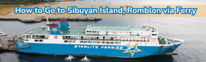
How to Go to Sibuyan Island, Romblon via Ferry
1.If you are coming from Batangas, Romblon, or Roxas City in Capiz, you may book a ticket for Starlite Ferries to Sibuyan Island.
- Batangas to Sibuyan Island: Daily Trips at 4:00 PM, approx. 12 hours
- Romblon, Romblon to Sibuyan Island: Daily trips at 2:00 AM, approx. 2 hours
- Roxas City, Capiz to Sibuyan Island: Trips on Monday, Wednesday to Saturday at 1:00 PM, approx. 5 hours
View Starlite Ferries’ Sibuyan Island schedules here.
2. Prepare to show your online booking at the port of departure.
3. Board the Starlite Ferries vessel and settle in your accommodation.
4. Arrive at the Port of Ambulong at Magdiwang, Sibuyan Island.
What to Prepare Before Hiking Mt. Guiting-Guiting

Before the hike, you must pay a visit to the DENR – Mt. Guiting-Guiting Natural Park Office to secure your permit. The process will be smoother if you coordinate with your guide and the office prior to your arrival at Sibuyan Island.
DENR Registration Fees:
- Php 1000 per head for foreigners
- Php 500 per head for non-residents of Sibuyan
- Php 250 per head for Sibuyan residents
Environmental / Tourism Fee:
- Php 100-200
Present the following:
- Valid ID
- Itinerary, licensed guide and porter (fees vary depending on guide, 5 mountaineers to 1 guide and 1 porter)
- Emergency contact
- Signed waiver
- Signed compliance for Leave No Trace
Essential Details You Need to Know Before Climbing Mount Guiting-Guiting
Mt. Guiting-Guiting Profile

Name
The name ‘Guiting-Guiting’ means ‘jagged’ in English. It aptly characterizes the saw-toothed appearance of the range. Locals and seasoned mountaineers call this range ‘G2’.
Elevation
Mt. Guiting-Guiting has an elevation of 2,058 meters above sea level, making it the highest point in Romblon.
Another stop on the way to Mt. Guiting-Guiting summit is Mayo’s Peak, which sits at 1,550 meters above sea level. Some hikers prefer to camp at this part of the trail due to its picturesque views.
Difficulty and Duration
Hiking enthusiasts have rated this mountain at 9/9 difficulty level. Hikes can take up to 3 days. Technical challenges such as the Knife Edge, Kiss the Wall, and the 90-Degree Wall make the trek extremely challenging. It is not a beginner-friendly mountain and only experienced mountaineers are recommended to climb.
Best Season to Climb
It is ideal to plan your Mt. Guiting-Guiting climb from December to May. The less complicated weather can treat you to majestic views of the surrounding range and at the summit. Climbers can also benefit from longer days during the summer season.
Avoid climbing in the rainy season because of the dangers posed by strong rains and winds. Trails can get very slippery and there is a high risk of landslide. The Mt. Guiting-Guiting Natural Park management suspends activities in the face of stormy weather.
Mt. Guiting-Guiting’s Technical Obstacles
1. Knife’s Edge
Mt. Guiting-Guiting climbers must cross Knife’s Edge to reach the summit wall from Mayo’s Peak. It has plenty of downward slopes that challenge trekkers as they traverse through this long, narrow ridge.
2. Kiss the Wall
The second challenge along the trail is the Kiss the Wall, with its name originating from the extremely narrow path you must pass through while facing the mountain wall. Any mistake in your step may lead to a precarious fall.
3. 90-Degree Wall
The last hurdle before reaching Mt. Guiting-Guiting summit is the 90-Degree Wall. You must make use of the grooves in the boulders to clamber up the vertical wall of rock.
Trails to Take at Mt. Guiting-Guiting

Tampayan Trail
The standard route is ideal if you are coming from the municipality of Magdiwang. It passes through Barangay Tampayan and takes you through Mayo’s Peak, and three technical challenges mentioned earlier.
Olango Trail
The exit trail is another hurdle in itself. The descent involves narrow ridges deep in a forest, huge boulders, and steep downward slopes of about 70 degrees. It gets steeper further close to the first camp until you reach the Olango river.
Itinerary at Mt. Guiting-Guiting

It is necessary to present an itinerary upon registration for a permit. Note that the DENR may recommend changes based on the weather conditions for the day. Seasoned mountaineers recommend the following itinerary for a 3-day hike:
Day 1 (Magdiwang)
- Register for a permit at Mt. Guiting-Guiting Natural Park Office
- Meet guide and undergo orientation
- Stay overnight at a campsite
Day 2 (Brgy. Tampayan Jump-Off)
- Begin trek from Brgy. Tampayan early in the morning
- Reach Mayo’s Peak by afternoon
- Stay overnight at Mayo’s Peak
Day 3 (Summit Assault)
- Begin trek to summit early in the morning
- Reach Mt. Guiting-Guiting summit before noontime
- Return to camp by afternoon
- Return to jump-off
- Arrive in town
Points to Remember When Conquering Mt. Guiting-Guiting

1. Train properly for the climb
G2 is considered the toughest climb in the Philippines for a reason. Its features are extreme and not beginner-friendly. Only experienced climbers are recommended to hike this mountain.
2. Solo climbs are prohibited
For safety purposes, the DENR and Mt. Guiting-Guiting Natural Park prohibits solo climbing. You are required to be accompanied by a licensed guide.
3. The DENR has the right to suspend climbs
In the event of bad weather, the local environmental agency may cancel climbs to ensure the safety of hikers.
4. Monitor weather conditions and travel advisories
To plan out your Mt. Guiting-Guiting hike more efficiently, look up the weather forecast and advisories of shipping lines to Sibuyan Island, PAGASA and the DENR.
5. Bring your own camping gear and food
Although tools for camping and cooking may be rented, taking your own helps you save on costs. Trail food may be more expensive on Sibuyan Island, so it’s best to prepare before your journey from the city.
6. Leave No Trace
Practice this principle during your hike to prevent damage to the natural beauty of Mt. Guiting-Guiting. Take your trash with you and dispose of it properly after the descent.
It is an exhilarating adventure to successfully and safely hike the most difficult mountains in the country. The pride of Sibuyan Island is a masterpiece of nature that must be appreciated and protected for future generations to experience.
ALSO READ: Everything You Need to Know About Romblon’s Top Tourist Attractions
Complete your hike goals at Sibuyan Island through Starlite Ferries. Our reliable vessels operate daily, offering comfortable and safe travel experiences across the seas of South Luzon, Visayas, and Mindanao. Book your ticket today.